Magnuz.se Sea Level
Magnuz of Sweden fictional extraterrestrial sea level change videos.
Contents
Contents.
Top
Videos
Videos of fictional sea level change on various celestial bodies.
Earth
The videos show hemispheres of Earth in ortographic projections on altitude-colored, relief-shaded maps with present coastlines outlined, while fictional sea levels drops from 9,000 m above present to 11,000 m below. The maps have corresponding to a 120° vertical field of vision, 18.5 km/px center resolution and the videos have lengths of 160 s or 16 s (fast). Videos are CC BY 2021 SeaLevelRise.se, rendered using custom PERL script, ImageMagick and FFmpeg, from open geodata, the GEBCO_2014 Grid, version 20150318.
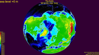
Earth, the Arctic, centered on (lat-N lon-E) +90° +000° (fast version).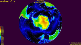
Earth, Antarctica, centered on (lat-N lon-E) -90° +000° (fast version).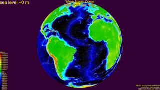
Earth, whole Atlantic Ocean, centered on (lat-N lon-E) +00° -030° (fast version).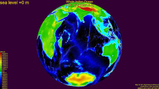
Earth, whole Indian Ocean, centered on (lat-N lon-E) -25° +075° (fast version).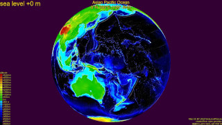
Earth, Asian Pacific Ocean, centered on (lat-N lon-E) +00° +160° (fast version).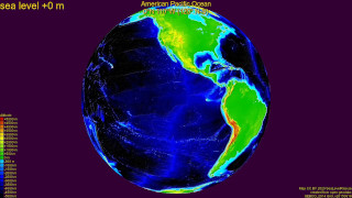
Earth, American Pacific Ocean, centered on (lat-N lon-E) +00° -110° (fast version).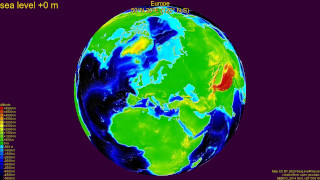
Earth, Europe, centered on (lat-N lon-E) +50° +020° (fast version).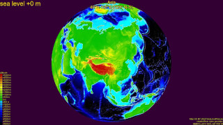
Earth, Asia, centered on (lat-N lon-E) +40° +100° (fast version).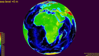
Earth, Africa, centered on (lat-N lon-E) +00° +020° (fast version).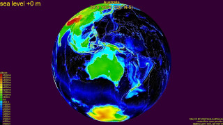
Earth, Australia, centered on (lat-N lon-E) -20° +140° (fast version).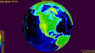
Earth, North America, centered on (lat-N lon-E) +40° -100° (fast version).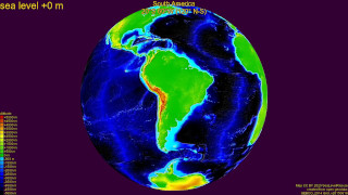
Earth, South America, centered on (lat-N lon-E) -20° -060° (fast version).
Top
Moon
The videos show hemispheres of the Moon in ortographic projections on altitude-colored, relief-shaded maps, while fictional sea levels drops from 10,800 m above the ellipsoid radius to 9,200 m below. The maps have corresponding to a 120° vertical field of vision, 5.0 km/px center resolution and the videos have lengths of 160 s or 16 s (fast). Videos are CC BY 2021 SeaLevelRise.se, rendered using custom PERL script, ImageMagick and FFmpeg, from open data, the NASA CGI Mon Kit.
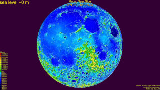
Moon, near side, centered on (lat-N lon-E) +00° +000° (fast version).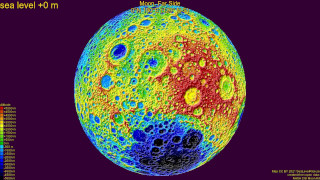
Moon, far side, centered on (lat-N lon-E) +00° +180° (fast version).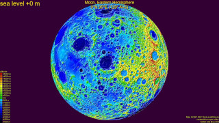
Moon, eastern hemisphere, centered on (lat-N lon-E) +00° +090° (fast version).
Moon, western hemisphere, centered on (lat-N lon-E) +00° +270° (fast version).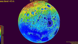
Moon, northern hemisphere, centered on (lat-N lon-E) +90° +000° (fast version).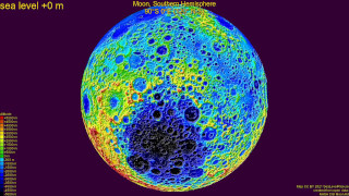
Moon, southern hemisphere, centered on (lat-N lon-E) -90° +000° (fast version).
Top
Mars
The videos show hemispheres of Mars in ortographic projections on altitude-colored, relief-shaded maps, while fictional sea levels drops from 11,000 m above the ellipsoid radius to 9,000 m below. The maps have corresponding to a 120° vertical field of vision, 9.9 km/px center resolution and the videos have lengths of 160 s or 16 s (fast). Videos are CC BY 2021 SeaLevelRise.se, rendered using custom PERL script, ImageMagick and FFmpeg, from open data, the NASA/USGS Mars MGS MOLA.
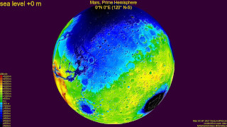
Mars, prime hemisphere, centered on (lat-N lon-E) +00° +000° (fast version).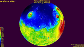
Mars, anti hemisphere, centered on (lat-N lon-E) +00° +180° (fast version).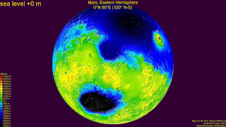
Mars, eastern hemisphere, centered on (lat-N lon-E) +00° +090° (fast version).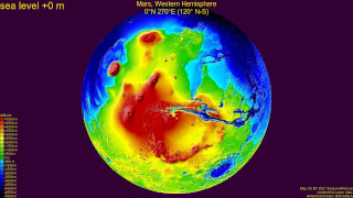
Mars, western hemisphere, centered on (lat-N lon-E) +00° +270° (fast version).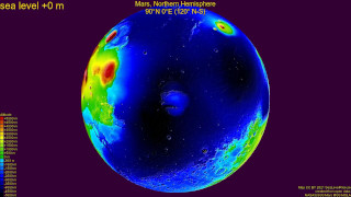
Mars, northern hemisphere, centered on (lat-N lon-E) +90° +000° (fast version).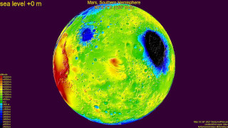
Mars, southern hemisphere, centered on (lat-N lon-E) -90° +000° (fast version).
Top
Venus
The videos show hemispheres of Venus in ortographic projections on altitude-colored, relief-shaded maps, while fictional sea levels drops from 12,000 m above the ellipsoid radius to 3,000 m below. The maps have corresponding to a 120° vertical field of vision, 17.6 km/px center resolution and the videos have lengths of 120 s or 12 s (fast). Videos are CC BY 2021 SeaLevelRise.se, rendered using custom PERL script, ImageMagick and FFmpeg, from open data, the NASA/USGS Venus Magellan.
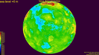
Venus, prime hemisphere, centered on (lat-N lon-E) +00° +000° (fast version).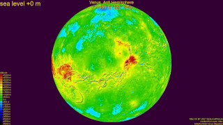
Venus, anti hemisphere, centered on (lat-N lon-E) +00° +180° (fast version).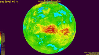
Venus, eastern hemisphere, centered on (lat-N lon-E) +00° +090° (fast version).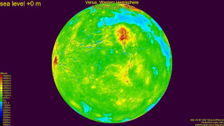
Venus, western hemisphere, centered on (lat-N lon-E) +00° +270° (fast version).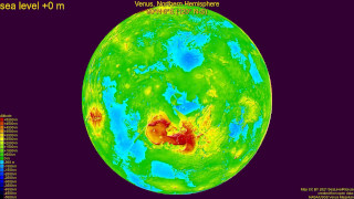
Venus, northern hemisphere, centered on (lat-N lon-E) +90° +000° (fast version).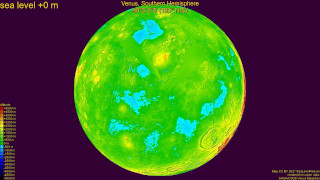
Venus, southern hemisphere, centered on (lat-N lon-E) -90° +000° (fast version).
Top
Mercury
The videos show hemispheres of Mercury in ortographic projections on altitude-colored, relief-shaded maps, while fictional sea levels drops from 4,600 m above the ellipsoid radius to 5,400 m below. The maps have corresponding to a 120° vertical field of vision, 7.1 km/px center resolution and the videos have lengths of 80 s or 8 s (fast). Videos are CC BY 2021 SeaLevelRise.se, rendered using custom PERL script, ImageMagick and FFmpeg, from open data, the NASA/USGS Mercury Messenger.
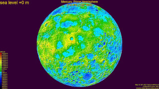
Mercury, prime hemisphere, centered on (lat-N lon-E) +00° +000° (fast version).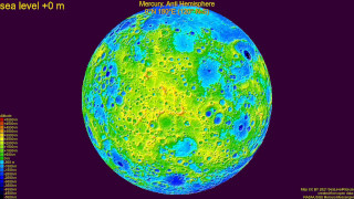
Mercury, anti hemisphere, centered on (lat-N lon-E) +00° +180° (fast version).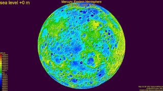
Mercury, eastern hemisphere, centered on (lat-N lon-E) +00° +090° (fast version).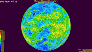
Mercury, western hemisphere, centered on (lat-N lon-E) +00° +270° (fast version).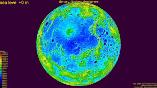
Mercury, northern hemisphere, centered on (lat-N lon-E) +90° +000° (fast version).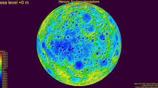
Mercury, southern hemisphere, centered on (lat-N lon-E) -90° +000° (fast version).
Top
Ceres
The videos show hemispheres of Ceres in ortographic projections on altitude-colored, relief-shaded maps, while fictional sea levels drops from 10,000 m above the ellipsoid radius to 8,000 m below. The maps have corresponding to a 120° vertical field of vision, 1.36 km/px center resolution and the videos have lengths of 144 s or 14 s (fast). Videos are CC BY 2021 SeaLevelRise.se, rendered using custom PERL script, ImageMagick and FFmpeg, from open data, the NASA/USGS Ceres Dawn.

Ceres, prime hemisphere, centered on (lat-N lon-E) +00° +000° (fast version).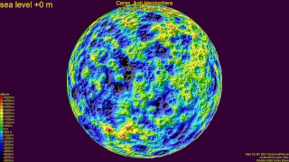
Ceres, anti hemisphere, centered on (lat-N lon-E) +00° +180° (fast version).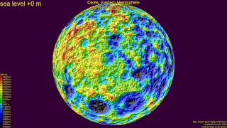
Ceres, eastern hemisphere, centered on (lat-N lon-E) +00° +090° (fast version).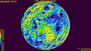
Ceres, western hemisphere, centered on (lat-N lon-E) +00° +270° (fast version).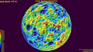
Ceres, northern hemisphere, centered on (lat-N lon-E) +90° +000° (fast version).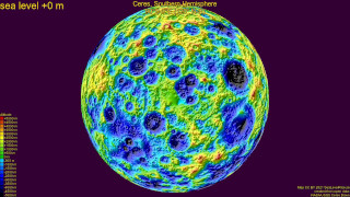
Ceres, southern hemisphere, centered on (lat-N lon-E) -90° +000° (fast version).
Top
Vesta
The videos show hemispheres of Vesta in ortographic projections on altitude-colored, relief-shaded maps, while fictional sea levels drops from 20,000 m above the ellipsoid radius to 20,000 m below. The maps have corresponding to a 120° vertical field of vision, 0.74 km/px center resolution and the videos have lengths of 160 s or 16 s (fast). Videos are CC BY 2021 SeaLevelRise.se, rendered using custom PERL script, ImageMagick and FFmpeg, from open data, the NASA/USGS Vesta Dawn.
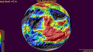
Vesta, prime hemisphere, centered on (lat-N lon-E) +00° +000° (fast version).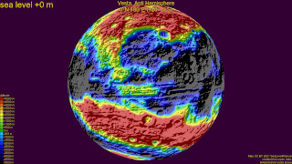
Vesta, anti hemisphere, centered on (lat-N lon-E) +00° +180° (fast version).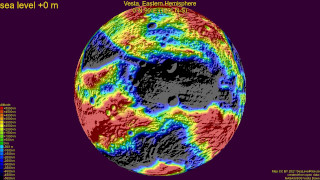
Vesta, eastern hemisphere, centered on (lat-N lon-E) +00° +090° (fast version).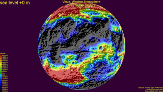
Vesta, western hemisphere, centered on (lat-N lon-E) +00° +270° (fast version).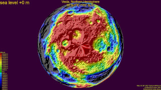
Vesta, northern hemisphere, centered on (lat-N lon-E) +90° +000° (fast version).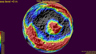
Vesta, southern hemisphere, centered on (lat-N lon-E) -90° +000° (fast version).
Top
Log
Reverse chronological log of sea level video events.
- 2023-04-16: Published this page.
- 2021-03-10: Finished Vesta hemisphere map videos.
- 2021-03-08: Finished Ceres hemisphere map videos.
- 2021-03-07: Finished Mercury hemisphere map videos.
- 2021-03-07: Finished Venus hemisphere map videos.
- 2021-03-06: Finished Mars hemisphere map videos.
- 2021-03-05: Finished Moon hemisphere map videos.
- 2021-02-20: Finished Earth hemisphere map videos.
- 2021-02-13: Finished first Earth hemisphere map video.
- 2020-07-23: Finished first hemisphere map video.
- 2018-09-23: Finished first map videos.
- 2018-09-22: Updated PERL script to render color map videos.
- 2018-09-22: Updated PERL script to render color map images.
- 2018-09-21: Created PERL script to render gray map images.
Top
This page, https://magnuz.se/astro/sealevel/index.html, © 2023 Magnuz of Sweden,
created 2023-04-16 and last updated 2023-04-16 by Magnuz of Sweden.